Difference between revisions of "File:HachiojiC.diagram.JPG"
From SamuraiWiki
Jump to navigationJump to search (Diagram of the castle as it was in the 16th century, viewed from the south. The approach was from the right. The residential area was at the bottom right. The Hon-maru was at the top of the mountain, with the Matsuki Circuit 松木曲輪 just below it.) |
(No difference)
|
Latest revision as of 02:50, 7 May 2008
Diagram of the castle as it was in the 16th century, viewed from the south. The approach was from the right. The residential area was at the bottom right. The Hon-maru was at the top of the mountain, with the Matsuki Circuit 松木曲輪 just below it.
File history
Click on a date/time to view the file as it appeared at that time.
| Date/Time | Thumbnail | Dimensions | User | Comment | |
|---|---|---|---|---|---|
| current | 02:50, 7 May 2008 | 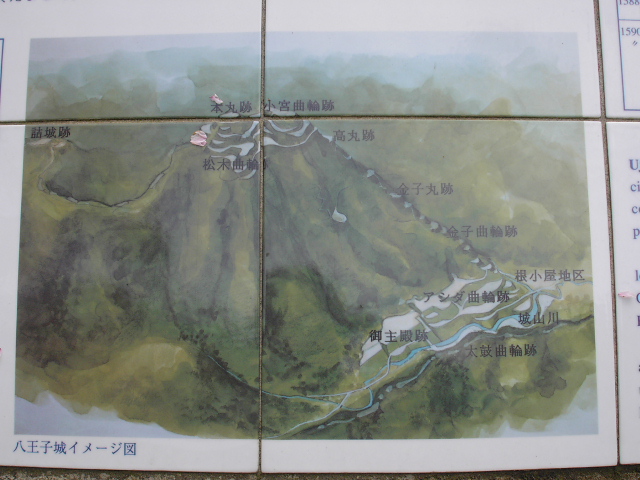 | 640 × 480 (208 KB) | Bethetsu (talk | contribs) | Diagram of the castle as it was in the 16th century, viewed from the south. The approach was from the right. The residential area was at the bottom right. The Hon-maru was at the top of the mountain, with the Matsuki Circuit 松木曲輪 just below it. |
You cannot overwrite this file.
File usage
The following page uses this file: